Geomaticians

Cooperation

Esri’s ArcGIS Basemaps And ArcGIS Living Atlas Data To Be Integrated Into Autodesk Software Environment

Industry leaders are relying on the interoperability of geographic information systems (GIS) and building information modeling (BIM) to reduce costs and boost efficiency across construction projects. In support of these organizations, Esri, and Autodesk have cultivated a strategic alliance to unify GIS and BIM, delivering real business value to architects, engineers, planners, and contractors. Deepening ...
azobuild.com
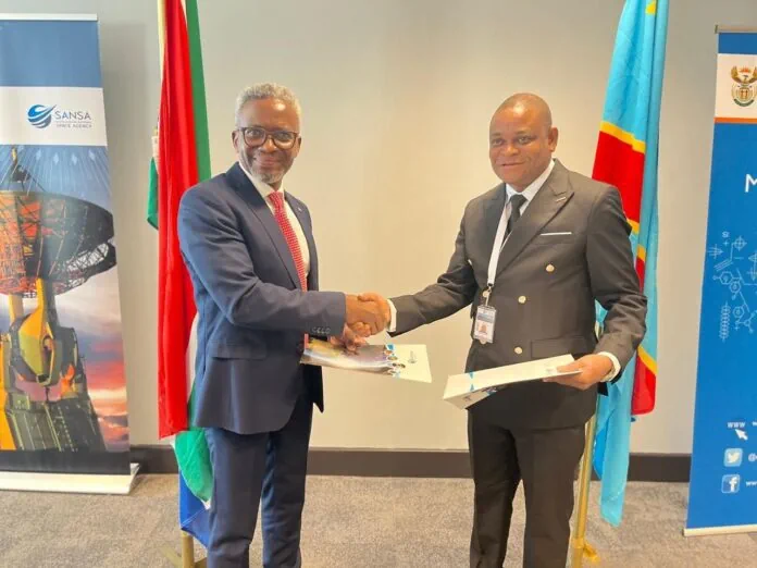
SANSA And Congo’s National Remote Sensing Centre Sign MoU To Advance Scientific Projects

SANSA And Congo’s National Remote Sensing Centre Sign MoU To Advance Scientific Projects

The South African National Space Agency (SANSA) and Democratic Republic of Congo National Remote Sensing Centre (DRC NRSC/CNT) recently signed a Memorandum of Understanding (MoU) during the 2023 GEO-Ministerial Summit in Cape Town to enhance collaborative efforts in implementing scientific and technological projects and programmes. The agreement underscores a shared commitment to promote mutual socio-economic ...
africanews.space

UP42 And GLOBHE Sign Partnership To Bring Drone Data To Geospatial Marketplace

UP42, a leading geospatial developer platform and marketplace, and GLOBHE, the world’s premier on-demand drone data marketplace, announced their partnership to make high-quality drone data available through UP42. The agreement expands UP42’s current offer of satellite, aerial, elevation, weather, AIS and RF data. “The addition of GLOBHE’s drone data to our marketplace underscores our commitment ...
amerisurv.com

RCMRD And CRTEAN Sign Agreement On Geospatial Training And Projects

Dr Emmanuel Nkurunziza, the Director-General of the Regional Centre for Mapping of Resources for Development (RCMRD), and Dr El-Hadi Gashut, the Director General of the Regional Center for Remote Sensing of North Africa States (CRTEAN), have signed a memorandum of understanding today to promote collaboration on geospatial projects and training. This partnership aims to avail ...
africanews.space

EUSI And Pixxel Partner For Hyperspectral Imagery Offerings

European Space Imaging (EUSI) and Pixxel have announced a strategic partnership that will give customers access to the “world’s most detailed hyperspectral imagery” from Pixxel directly through EUSI. Together with EUSI’s capability to build insights and products, the partnership has the potential to set a new benchmark in remote sensing applications in the region. Furthermore, ...
spacewatch.global
Trimble’s GNSS Technology To Aid Landmine Identification And Clearance In Ukraine

Trimble’s GNSS Technology To Aid Landmine Identification And Clearance In Ukraine

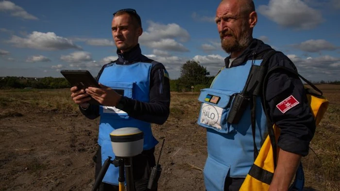
Trimble has announced a partnership with the HALO Trust, the world’s largest landmine-clearing non-profit organization, to help expand its demining operations across Ukraine. The grant from the Trimble Foundation Fund will focus on strengthening the HALO Trust’s capacity to locate and remove landmines, unexploded ordnance and other explosive hazards from civilian areas to create safer ...
gim-international.com

ESA And EC To Unite On Climate Action From Space

ESA and the Commission’s Directorate-General for Climate Action (CLIMA) are, therefore, seizing the opportunity to harness their combined expertise and resources to bring about transformative change, not least in the context of the EU’s Copernicus space programme and ESA’s Space for a Green Future Accelerator. ESA and CLIMA are reinforcing their cooperation by working together ...
azocleantech.com
Naver To Build Digital Twin Platform For Saudi Cities

Naver To Build Digital Twin Platform For Saudi Cities

South Korean internet giant Naver said Tuesday it has secured a large-scale deal in Saudi Arabia to build a cloud-based digital twin platform for the kingdom’s futuristic smart city project. The deal signing ceremony was held in Saudi capital Riyadh on Monday upon President Yoon Suk Yeol’s state visit. Naver didn’t reveal the exact size ...
theinvestor.co.kr

Transportes Firma Un Convenio Con La Asociación Española De Geografía Para Asegurar La “Excelencia” Del Atlas Nacional De España

El Ministerio de Transportes, Movilidad y Agenda Urbana ha firmado, a través del Instituto Geográfico Nacional (IGN) y el Centro Nacional de Información Geográfica (CNIG), un convenio con la Asociación Española de Geografía (AGE) para “asegurar la excelencia científica” del Atlas Nacional de España. Según el departamento dirigido por Raquel Sánchez, el objeto de este ...
lavanguardia.com
India’s Leading Drone Tech Company IG Drones Enters Global Partnership With Korea-based IGiS At GITEX Dubai

India’s Leading Drone Tech Company IG Drones Enters Global Partnership With Korea-based IGiS At GITEX Dubai

India’s foremost drone technology company, IG Drones, has forged a strategic alliance with iGiS, a Korean specialist in geospatial information-based drone solutions, announced during the prestigious North Star GITEX Global event. IG Drones and iGiS have formed a significant partnership through a strategic Memorandum of Understanding (MOU). This collaboration aims to leverage their strengths for ...
livemint.com

La Universidad De León Desarrollará Innovación Tecnológica Para Impulsar La Unidad De Drones De La UME

La secretaria de Estado de Defensa y presidenta de ISDEFE (Ingeniería de Sistemas para la Defensa de España), Amparo Valcarce, y el rector de la Universidad de León (ULE), Juan Francisco García Marín han firmado este jueves en el Palacio de Congresos y Exposiciones de la capital leonesa un Protocolo General de Actuación para impulsar ...
actualidadaeroespacial.com

Porozumienie GGK Ze Stowarzyszeniem Geodetów Polskich

Główny Geodeta Kraju Alicja Kulka zawarła porozumienie ze Stowarzyszeniem Geodetów Polskich (SGP), w którym wyrażono wolę i gotowość dalszej współpracy na rzecz rozwoju geodezji i kartografii w Polsce. Porozumienie, które zawarto 18 października 2023 r. dotyczy współpracy między innymi w zakresie: rozwoju geodezji i kartografii w Polsce, a w szczególności wykorzystania w pracach geodezyjnych oraz ...
gisplay.pl

U.S. Gathers Experts To Tackle Illegal Mining In Ghana

The U.S. Department of State, the U.S. Embassy Ghana, and the University of Mining and Technology (UMaT), Tarkwa are convening mining stakeholders from across Ghana to brainstorm tech-enabled solutions to illegal mining. As part of “Tech Camp Takoradi” this week, fifty stakeholders including representatives of mining communities and companies, scientists and innovators, policymakers, environmental activists, ...
gh.usembassy.gov
Open Cosmos’ MANTIS Satellite Prepped For Upcoming Launch

Open Cosmos’ MANTIS Satellite Prepped For Upcoming Launch

MANTIS was successfully integrated with its EXOpod Nova deployment system in Berlin, provided by Exolaunch as part of their mission management and integration service, prior to completing its integrations with SpaceX’s Falcon 9 before lift-off from Vandenberg Space Force Base. MANTIS, which stands for Mission Agile Nanosatellite for Terrestrial Imagery Services, will be the first ...
news.satnews.com
Azercosmos, Bayanat Sign Agreement On Development Of Geographic Information Systems

Azercosmos, Bayanat Sign Agreement On Development Of Geographic Information Systems

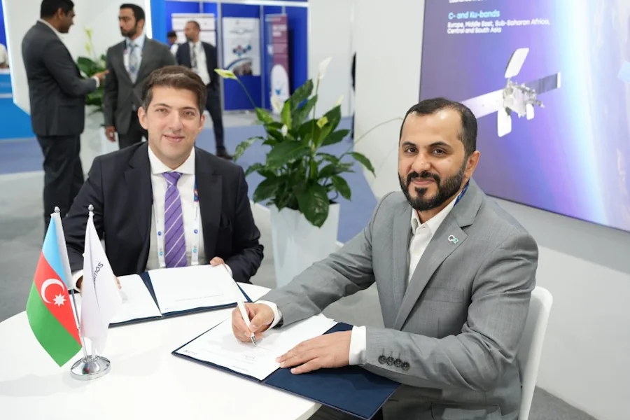
Azercosmos and Bayanat company of the United Arab Emirates (UAE) have signed a cooperation agreement. According to the agreement, the parties will cooperate in the area of Geographic Information Systems (GIS). This includes promoting potential projects and opportunities for the acquisition, processing and application of remote sensing data, geospatial data capabilities, experience and knowledge sharing. ...
azertag.az

Cidade De São Paulo Apresenta GeoSampa Para Dez Cidades Ibero-Americanas

A Prefeitura de São Paulo está levando a dez cidades ibero-americanas seu conhecimento na utilização de georreferenciamento de dados e a sua contribuição para o incentivo de políticas públicas. As cidades participam de um workshop on-line, que teve a primeira aula realizada nesta terça-feira (10) com o tema “Geoprocessamento de Dados para o Planejamento Urbano”. ...
capital.sp.gov.br

Convenio Entre Mitma Y La Xunta De Galicia Para Obtener Imágenes Aéreas

El Consejo de Ministros ha autorizado la firma de un convenio entre el Ministerio de Transportes, Movilidad y Agenda Urbana (Mitma), a través del Instituto Geográfico Nacional (IGN) y el Organismo Autónomo Centro Nacional de Información Geográfica (CNIG), y la Xunta de Galicia para la obtención de una cobertura completa de imágenes aéreas y ortofotos ...
fly-news.es
Tribal Leaders And Researchers Have Mapped The Ancient ‘Lost Suburbs’ Of Los Angeles

Tribal Leaders And Researchers Have Mapped The Ancient ‘Lost Suburbs’ Of Los Angeles

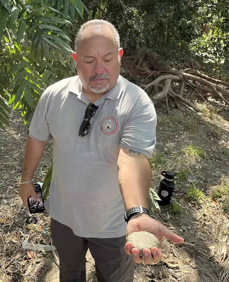
For millions of Los Angeles-area motorists, the Whittier Narrows Recreation Area flashes by in an instant — a tattered oasis of wetlands, sycamore and oak that punctuates the monotonous sprawl of industrial parks, cinder-block sound walls and residential cul-de-sacs along the 60 Freeway and Rosemead Boulevard. But to Andrew Salas, chairman of the Gabrieleño-Kizh tribe, ...
latimes.com
RD Y Cuba Unirán Capacidades Para Desarrollar Atlas De Riesgo Climático

RD Y Cuba Unirán Capacidades Para Desarrollar Atlas De Riesgo Climático

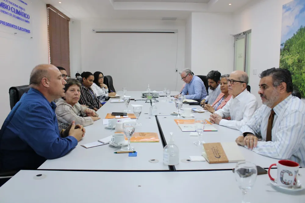
República Dominicana y Cuba exploran vías de intercambio y colaboración para impulsar los Atlas de Riesgo Climático de ambos países, basándose en las capacidades y fortalezas que cada uno de ellos ha desarrollado en materia de observación geoespacial; recolección y sistematización de datos; y desarrollo de las plataformas tecnológicas. “Cuba ha desarrollado y actualiza cada ...
visitantes.do
THEOS-2 Airbus-built Satellite For Thailand Successfully Launched

THEOS-2 Airbus-built Satellite For Thailand Successfully Launched

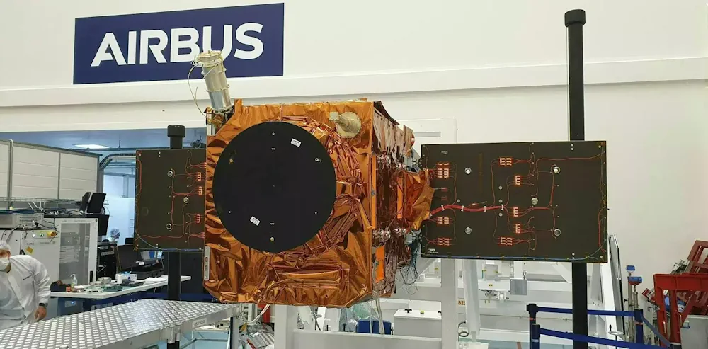
The Airbus-built THEOS-2 Earth observation satellite has been successfully launched on a Vega rocket from Kourou, Europe’s spaceport in French Guiana. The Geo-Informatics and Space Technology Development Agency of Thailand (GISTDA) selected Airbus as partner for its next-generation national geo-information system in 2018. Jean-Marc Nasr, Head of Space Systems at Airbus, said: “This successful launch ...
airbus.com

Trimble And Kyivstar Partner To Provide GNSS Correction Services For Agriculture, Construction And Geospatial Applications In Ukraine

Trimble and Kyivstar, Ukraine’s largest telecommunications company, are partnering to install a new Continuously Operating Reference Station (CORS) network to provide Global Navigation Satellite System (GNSS) correction services across the country. Available to users as an annual subscription service, the new network will be built using Trimble’s hardware and software positioning technology, which provides customers ...
agritechtomorrow.com

Politechnika Lubelska Opracowuje Cyfrowego Bliźniaka Zamościa

Model cyfrowego bliźniaka Zamościa powstaje w ramach międzynarodowego projektu naukowego „Zero energy buildings for zero energy neighbourhoods ZEB4ZEN”. Jego budżet to ponad 2 miliony euro. Głównym celem przedsięwzięcia jest opracowanie ponadnarodowej metodologii i regionalnych planów działania, które pokażą, jak do roku 2050 przekształcić historyczne dzielnice miejskie w dzielnice o niemal zerowym zużyciu energii. „Miasta idealne” ...
geoforum.pl

Esri NA Signs Deal To Provide Egypt With GIS Programs

Egyptian Ministry of Communications and Information Technology has signed an agreement with the geographic information system (GIS) software firm Esri North Africa (Esri NA) to provide the latter’s latest GIS programs to the Egyptian universities, a statement showed. The deal also aims to build the capacities of the Egyptian staff in the field of GIS ...
zawya.com

Bayanat Partners With HySpecIQ And AzurX To Enable Hyperspectral Imaging And Analysis For The UAE

HySpecIQ, a hyperspectral imaging and data analytics company, today announced a partnership with Bayanat, an ADX-listed public company and provider of AI-powered geospatial solutions. The relationship between HySpecIQ and Bayanat will support the creation of hyperspectral data applications as well as the development of systems that can combine hyperspectral with other geospatial data to produce ...
geospatialworld.net
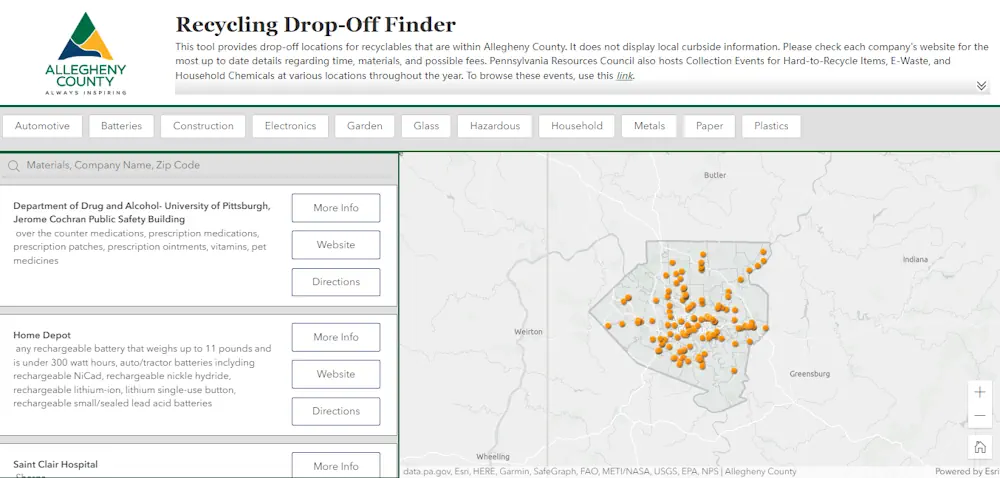
New Pittsburgh Database Can Help You Find Recycling Locations

사천시, 디지털트윈 스마트도시 구축 현실화

사천시가 지난 13일 한국국토정보공사(LX) 경남지역본부(본부장 배종욱)와 ‘디지털트윈 기반 스마트도시 구축을 위한 업무협약’을 체결했다고 14일 밝혔다. 양 기관은 이번 협약을 통해 디지털트윈(가상모형) 플랫폼 구축 및 서비스, 인프라 지원·협력과 3차원 데이터 구축 등에 대한 상호협력을 약속했다. 주요 내용은 △디지털트윈 기반 스마트도시 실현을 위한 정보 및 기술 공유 △한국국토정보공사(LX) 플랫폼 기반 행정 및 산업서비스 모델 공동 활용 △스마트 ...
gnmaeil.com

AWS Ties Up With ISRO And IN-SPACe To Advance India’s Space Capabilities With Cloud Technologies

Amazon Web Services (AWS) India Private Limited has signed a strategic Memorandum of Understanding with the Indian Space Research Organization (ISRO) and Indian National Space Promotion and Authorization Centre (IN-SPACe) to support space-tech innovations through cloud computing. This collaboration will give space startups, research institutes and students access to cutting edge cloud technologies that accelerate ...
aboutamazon.in
Microsoft And Esri To Speed Up Access To Earth-Observation Data

Microsoft And Esri To Speed Up Access To Earth-Observation Data

To speed up access to Earth observation data for millions of customers, Esri is closely integrating its ArcGIS geographic mapping platform with Microsoft Azure Space. “We’re putting the entire technology stack in Azure Space data centers,” Richard Cooke, Esri, imagery and remote sensing director, told SpaceNews at the World Satellite Business Week conference here. “We ...
spacenews.com

German Start-Up And Airbus Defence Space Team Up On Datacubes

German Start-up Rasdaman GmbH and Airbus Defence and Space announce a collaboration towards the next generation of Earth Observation exploitation services, centred around spatio-temporal datacubes, to pave the way for a dynamic version of the CopDEM for analytics in the cloud. “We add new features by the week, inspired by the impressive quality the data ...
geospatialworld.net

Association For Royal Geographical Society Renew Collaboration

The Association for Geographic Information (AGI), the UK membership organisation for companies and individuals working in the geospatial sector, and the Royal Geographical Society (with the Institute of British Geographers) (RGS-IBG) have signed a new Memorandum of Understanding (MoU). This strategic alliance, in alignment with both organisation’s objectives and strategies, will strengthen communications to maximise ...
directionsmag.com
EuroGeographics And International Cartographic Association Agree Collaboration To Unlock Power Of Location

EuroGeographics And International Cartographic Association Agree Collaboration To Unlock Power Of Location

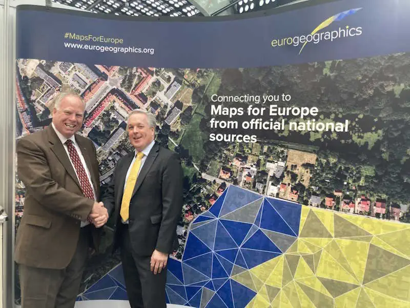
Experts in authoritative geospatial data, cartography and GIScience have today (29 August 2023) announced a new international collaboration to demonstrate the power of location. Members of EuroGeographics, the not-for-profit association for European National Mapping, Cadastral and Land Registration Authorities, and the International Cartographic Association (ICA) will use their collective expertise to support the public good. ...
directionsmag.com