Geomaticians

Hydrography

Antarktika Bilim Seferi'nin Haritacıları, Beyaz Kıta'da Piri Reis'in Izinde

Antarktika Bilim Seferi’nin “Haritacıları”, Beyaz Kıta’da Piri Reis’in Izinde

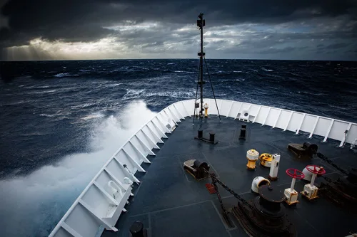
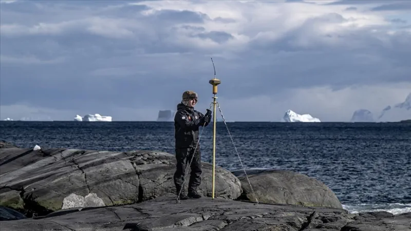
Milli Savunma Bakanlığına bağlı Harita Genel Müdürlüğü ve Türk Deniz Kuvvetleri Seyir, Hidrografi ve Oşinografi Dairesi Başkanlığı, 7. Ulusal Antarktika Bilim Seferi’ne katılarak, Piri Reis’in izinde, kıtada denizden ve karadan koordinatları belirlemeye yönelik ölçümler yaptı. Cumhurbaşkanlığı himayelerinde, Sanayi ve Teknoloji Bakanlığı uhdesinde, TÜBİTAK MAM Kutup Araştırmaları Enstitüsü koordinasyonunda gerçekleştirilen 7. Ulusal Antarktika Bilim Seferi kapsamında, ...
aa.com.tr
Almost A Quarter Of The Ocean Floor Is Now Mapped

Almost A Quarter Of The Ocean Floor Is Now Mapped

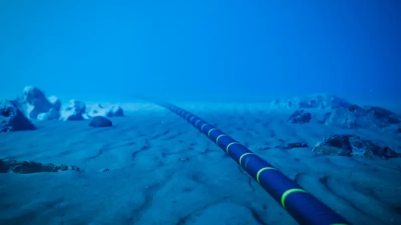
Roughly 25 percent (23.4 percent to be exact) of the Earth’s sea floor has been mapped, thanks to an international initiative known as Seabed 2030. Relying largely on voluntary contributions of bathymetric data (or ocean topography) by governments, companies and research institutions, the project is part of a larger UN-led initiative called The Ocean Decade. ...
engadget.com
Litto3d, Un Outil Gratuit Du SHOM Pour Découvrir Les Reliefs Maritimes

Litto3d, Un Outil Gratuit Du SHOM Pour Découvrir Les Reliefs Maritimes

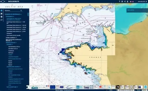
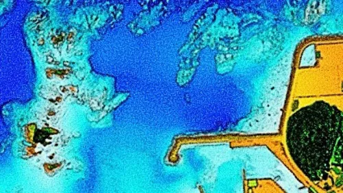
Litto3D est un outil cartographique mis à disposition par le SHOM en accès gratuit. Ce produit propose une cartographie de l’altimétrie littorale, que ce soit à terre ou en mer pour une grande partie des côtes françaises. Avec Litto3D, on se promène sur la carte en découvrant à la fois les reliefs terrestres et les ...
bateaux.com
Survei Garis Pantai Untuk BIG

Survei Garis Pantai Untuk BIG

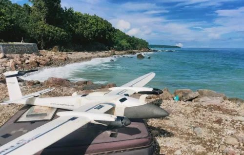
Pemanfaatan teknologi drone telah menyelesaikan proyek survei garis pantai sepanjang 1.080 kilometer. Hal ini dilakukan untuk kebutuhan data dari badan informasi geospasial (big) yang bertugas melaksanakan tugas pemerintahan di bidang informasi geospasial. “Hal ini menjadi tantangan bagi perusahaan-perusahaan teknologi drone untuk terus mengembangkan teknologi drone dan memberikan solusi terbaik bagi berbagai sektor industri, termasuk pemerintah,” ...
merahputih.com

Teledyne Introduces New Marine Lidar Sensor For USV

Teledyne Geospatial will bring its latest advancements in ocean mapping hardware and software solutions to Ocean Business 2023, being held at the National Oceanography Centre, Southampton, UK from April 18-20. Visitors to the Teledyne Geospatial booth U12 will be introduced to the CL-360 for marine applications, a lidar sensor that can be seamlessly integrated with ...
geospatialworld.net
URI Grad Student Mapping Shoreline Access In The State

URI Grad Student Mapping Shoreline Access In The State

Though just 37 miles wide and 48 miles long, Rhode Island boasts 400 miles of shoreline. And University of Rhode Island graduate student Erica Meier knows most all of its 400-plus public access points. Meier spent the summer and fall of 2022 visiting and recording public shoreline access points along the coast with 41°N editor ...

Mapping The Risks Of Isolation Due To Sea Level Rise Associated With Global Warming

A trio of environmental engineers, two with the University of Canterbury in New Zealand, the third with the University of Maryland, has developed a way to illustrate the impact of sea level rise isolation associated with global warming. In their paper published in Nature Climate Change, Tom Logan, M. J. Anderson and Allison Reilly describe ...
phys.org
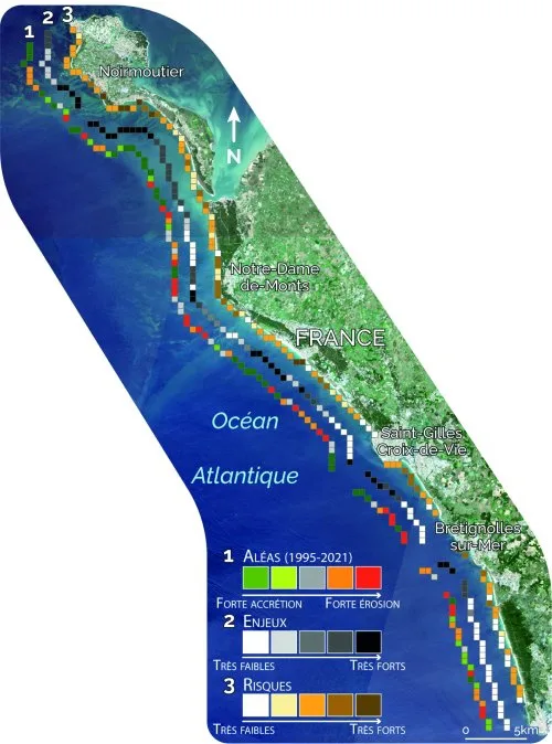
Les Données Satellitaires Au Service De La Gestion Des Littoraux Face Au Changement Climatique Bilan Du Programme Européen ‘ESA Coastal Erosion’ Mené Par I-sea

Les Données Satellitaires Au Service De La Gestion Des Littoraux Face Au Changement Climatique : Bilan Du Programme Européen ‘ESA Coastal Erosion’ Mené Par I-sea

Spécialisée dans la surveillance de la Biodiversité et du Littoral, l’entreprise bordelaise i-Sea est le chef de file de ESA Coastal Erosion, un programme européen de grande envergure initié en 2019 sous l’égide de l’ESA, l’Agence Spatiale Européenne. Basé sur l’observation satellitaire du littoral dans le but de prévenir et lutter contre le recul du ...
cdurable.info

NV5 Geospatial Begins Pilot Project To Analyze Climate Change For Caribbean Nations

NV5 Geospatial, North America’s most comprehensive geospatial science data firm, today announced that it will conduct aerial lidar and orthoimagery surveys across the Caribbean on behalf of the Caribbean Community Climate Change Centre (CCCCC). Funded by the Caribbean Development Bank (CDB), this pilot project will provide advanced geospatial data to help the island nations better ...
smartcitiesdive.com

Geospatial World Forum Returns To Rotterdam With Industry-advancing Agenda

This year marks the 14th edition of Geospatial World Forum (GWF), a platform for global geospatial community, attended by senior executives representing public policies, national geospatial and space agencies, large business enterprise users, commercial companies, and professional and academic institutions from 75+ countries. After three consecutive years in Amsterdam, the event returns to Rotterdam, to ...
geospatialworld.net
United States, Australia Ocean Science Agencies Team Up To Explore And Map Pacific Ocean

United States, Australia Ocean Science Agencies Team Up To Explore And Map Pacific Ocean

NOAA and two of Australia’s leading science agencies announced a formal agreement Tuesday to work together to advance Pacific Ocean exploration and mapping, a major priority for NOAA and of the United Nations Decade of Ocean Science for Sustainable Development. The memorandum of understanding (MOU) was signed by NOAA Administrator Rick Spinrad, Ph.D., Geoscience Australia ...
oceanexplorer.noaa.gov
Japan Launches Project To Map 90% Of Coastal Waters

Japan Launches Project To Map 90% Of Coastal Waters

The ‘Umi-no-Chizu’ (‘Map of the Sea’) project will use aerial measurement to map 90% of Japan’s shallow coastal waters (to a depth of 20m). This is a joint project by the Japan Hydrographic Association (JHA) and The Nippon Foundation. Regulatory, administrative management and jurisdiction issues have meant that less than roughly 2% of Japan’s coastal ...
gim-international.com
University Of Plymouth Integrates Geoacoustics Sub-bottom Profiler Into Hydrography Programmes

University Of Plymouth Integrates Geoacoustics Sub-bottom Profiler Into Hydrography Programmes

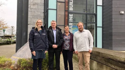
The University will take delivery of the system, which includes an Over-the-Side (OTS) transducer mount for deployment flexibility, this December. The partnership also includes the potential to switch to a next-generation GeoPulse system in 2023 as well as a one-day guest lecture and processing workshop for the University’s MSc Hydrography and BSc Ocean Exploration and ...
hydro-international.com
Kostengünstiger Sensor Erfasst Den Pegel Von Flüssen

Kostengünstiger Sensor Erfasst Den Pegel Von Flüssen

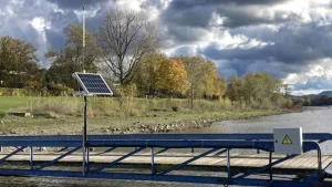
Forschende der Universität Bonn haben ein Verfahren entwickelt, mit dem sich der Wasserstand von Flüssen rund um die Uhr überwachen lässt. Der kostengünstige Sensor eignet sich etwa für flächendeckende Hochwasser-Warnsysteme. Die Studie ist in der Zeitschrift Water Resources Research erschienen. „Kern unseres Geräts ist ein kostengünstiger GNSS-Empfänger“, erklärt Dr. Makan Karegar vom Institut für Geodäsie ...
innovations-report.de

Oceansat-3 To Be Launched On Nov 26: Jitendra Singh

India will launch the Oceansat-3 satellite on November 26, Earth Sciences Minister Jitendra Singh said on Tuesday. Singh said the Ministry of Earth Sciences has taken the notion of ‘marine surveillance’ to a new level, where space applications are also being deployed to share the valuable inputs with the security agencies, an official statement said. ...
theprint.in

New Geological Map Of Offshore Anglesey Released

The British Geological Survey (BGS) has released a new fine-scale digital map featuring the seabed geology of offshore Anglesey. The island (in Welsh known as Ynys Môn) follows the Bristol Channel as the second in a series of new fine-scale maps that contain combined bedrock, sediment, bedrock structure and seabed geomorphology data. The maps are ...
hydro-international.com

OGC Seeking Information Concerning Regional And International Marine Spatial Data Infrastructure

The Open Geospatial Consortium (OGC) seeks, in support of the OGC Federated Marine Spatial Data Infrastructure Pilot (Phase 3), to gather and identify the requirements and use cases for a regional/international MSDI via a short online survey. Responses are due by November 15, 2022. The survey will help shape the ongoing OGC FMSDI Pilot and ...
directionsmag.com

Surveillance Satellitaire : Unseenlabs S’associe À Un Spécialiste De L’analyse Géospatiale

La société française Unseenlabs, spécialisée dans les nano-satellites de géolicalisation, vient de conclure un partenariat avec Ursa Space Systems, un spécialiste de l’analyse géospatiale, pour fournir des solutions visant à la surveillance des espaces maritimes, dans un but de sûreté et de sécurité maritime. Ce nouveau partenariat vise à permettre permet d’améliorer la surveillance du ...
meretmarine.com

Polskie Pomiary Batymetryczne Na Grzbiecie Śródatlantyckim

Specjaliści z Państwowego Instytutu Geologicznego-PIB wraz zaproszonymi do współpracy naukowcami z polskich ośrodków badawczych (tj. Politechniki Morskiej w Szczecinie, Instytutu Nauk Geologicznych Polskiej Akademii Nauk, Uniwersytetu Gdańskiego oraz Uniwersytetu Adama Mickiewicza w Poznaniu) prowadzą od trzech tygodni kompleksowy rekonesans obszaru o powierzchni 10 tys. km kw. objętego Umową z Międzynarodową Organizacją Dna Morskiego.
geoforum.pl

Mapping US Coastlines May ‘Drive More Equality’ In Climate Adaptation Policy

A Canadian technology company is using aerial imagery to build high-precision maps of US shorelines that will be used to help coastal communities adapt to climate change. By cataloguing which neighborhoods have more impervious surfaces like sidewalks and driveways compared to permeable ground with vegetation and trees, policymakers can better predict where heat waves or ...
financialpost.com

New Classification Of The World’s Coastlines To Improve Climate Action

A new classification of the world’s coastlines has been released to improve coastal climate change adaptation at local, regional and national level and strengthen coordinated climate action worldwide. The classification builds on the Coastal Hazard Wheel that is a universal coastal management framework and is developed by the Coastal Hazard Wheel initiative involving Deltares, the ...
„Sea Level Map“ Zeigt Meeresspiegelanstieg Am Beispiel Von Norddeutschland

„Sea Level Map“ Zeigt Meeresspiegelanstieg Am Beispiel Von Norddeutschland

Forscher:innen aus der Geodäsie und Geoinformatik haben anhand einer Webkarte die wissenschaftlichen Ergebnisse für den Meeresspiegelanstieg visualisiert. Die interaktive Karte bildet mögliche Klimaszenarien ab. Die verschiedenen Klimaszenarien des Weltklimarates IPCC werden abgebildet und die interaktive Karte zeigt die Anzahl an betroffenen Personen in Norddeutschland an. Die Simulation zeigt verschiedene Szenarien des prognostizierten Meeresspiegelanstiegs für das ...
idw-online.de
US-European Satellite Will Make World’s First Global Freshwater Survey

US-European Satellite Will Make World’s First Global Freshwater Survey

Water is life, but for all its importance, humanity has a surprisingly limited view of Earth’s freshwater bodies. Researchers have reliable water level measurements for only a few thousand lakes around the world, and little to no data on some of the planet’s important river systems. The upcoming Surface Water and Ocean Topography (SWOT) satellite ...
jpl.nasa.gov
Tandanor Avanza En La Construcción De Un Nuevo Buque De Investigación Hidrográfica

Tandanor Avanza En La Construcción De Un Nuevo Buque De Investigación Hidrográfica

Un nuevo buque de investigación hidrográfica, destinado a relevamientos indispensables para la navegación en el Río de la Plata y el Mar Argentino, es construido por el astillero estatal Tandanor en su planta de Costanera Sur, donde espera botarlo a las aguas durante el próximo mes de septiembre. El buque, bautizado “Petrel“, tiene la apariencia ...
lacapitalmdp.com

UK Hydrographic Office Calls For UK Government Organisations Involved In Seabed Mapping To Join Newly Unveiled UK Centre For Seabed Mapping

The UK Hydrographic Office (UKHO) is inviting UK government organisations involved in seabed mapping who share common interests in optimising the UK’s national maritime assets to become a member of the newly unveiled UK Centre for Seabed Mapping. The UK Centre for Seabed Mapping (UK CSM) is administered by the UKHO, and was submitted as ...
gcaptain.com