The University of Florida’s Center for Landscape Conservation Planning (CLCP) and GeoPlan Center have developed two new tools to support land protection decisions in Florida – a web map viewer and web-based dashboard for the Florida Ecological Greenway Network (FEGN).
The FEGN is a statewide database that identifies and prioritizes a functionally connected statewide ecological network of public and private conservation lands. The CLCP is the lead entity maintaining this database, which provides the science foundation and boundaries for the Florida Wildlife Corridor.
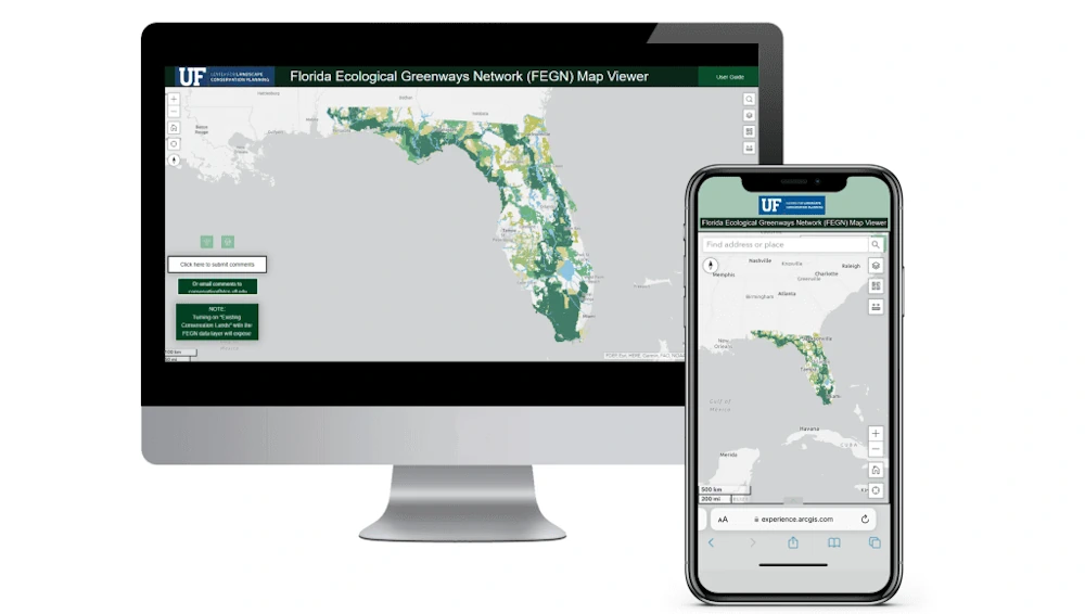
The FEGN map viewer is designed to make the Florida Ecological Greenways Network easier to explore. It includes information about existing and proposed conservation lands, future development scenarios, political boundaries, sea level rise projections, and more. “The viewer also highlights opportunity areas for protection within the FEGN, and will be useful to government officials, land conservation planning professionals or interested citizens – with the ultimate goal of better supporting data-driven and strategic decisions for land protection in Florida.”
The web-based dashboard that the CLCP launched focuses on the opportunities and threats associated with the FEGN at various scales. Its initial view displays projected development through the year 2070 at a statewide scale. Users can also select a specific county or political district to view the FEGN in conjunction with development trend statistics for that area. The dashboard also shows the counties where the FEGN is most and least protected and where development is projected to pose the greatest threat.